.png)
I’m back… And yes, Myanmar is amazing!
- Audrey Chin

- Mar 22, 2013
- 3 min read
Updated: Jun 10, 2022
A picture is worth a 1000 words. I have so much to say, I’m just going to surrender and go with the snapshots. For the more in-depth stuff … wait for the short stories.

Credit: National Geographic Magazine
A river runs through it.
The Ayeryawaddy is the lifeline of Myanmar. Starting 1,300 miles up in the Himalayan Range, it runs through Myanmar’s jungly and strife worn Northern regions to the hot and dusty plains of Central Burma before reaching the Andaman Sea just East of India.
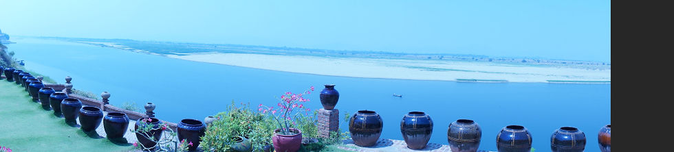
We met the river at the Ancient Capital of Bagan. Here’s the view of the river from a restaurant we had lunch at.
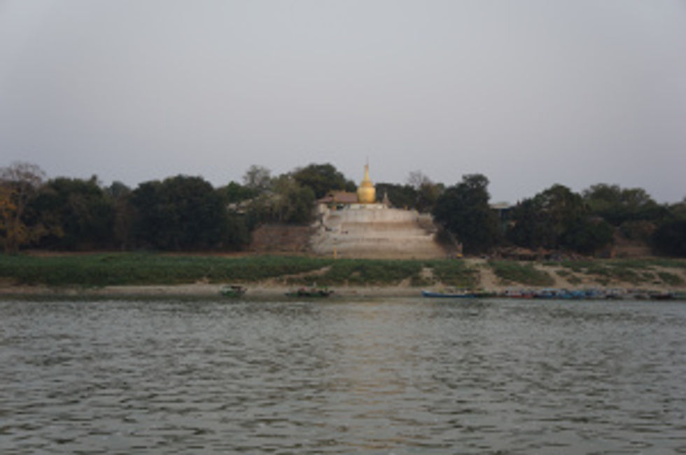
Bagan was first settled in the 2nd century by the Pyu people, the earliest inhabitants of Myanmar with a extant records. The only Pyu temple left in Bagan, on the banks of the Ayerywaddy, is pictured below.
The almost 2000+ monuments remaining from that period that draw tens of thousands of tourists to the plains of Bagan are the subject of my next post. On our journey up the Ayeryawaddy however, what’s important about Bagan is that the civilization there collapsed due to repeated Mongolian invasions into Upper Burma. As a result, the center of power moved to Sagaing, a hilly region further upriver, surrounded by three banks of the Ayeryawaddy and with a commanding view of the North Eastern plains from which the Mongolian horsemen might be expected to come.
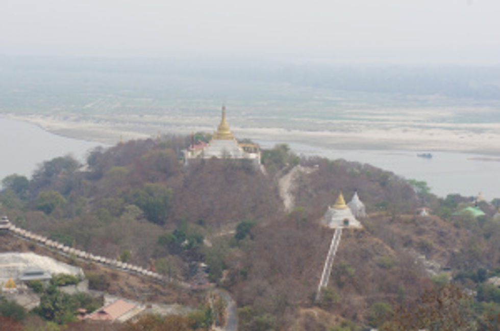
Sagaing, however, was a capital only from 1315-1365. The Ava kings, who ruled this new kingdom, subsequently moved the capital to Innwa or Ava, at the South Bank of the Ayeryawaddy and it’s confluence with Myintge River and surrounded by 7 lakes and the rice-fields of Kyaukse.
Innwa was to remain a capital of the Ava, Toungoo and Konbaung kings for over 360 years until 1839, when the city was destroyed by an earthquake.
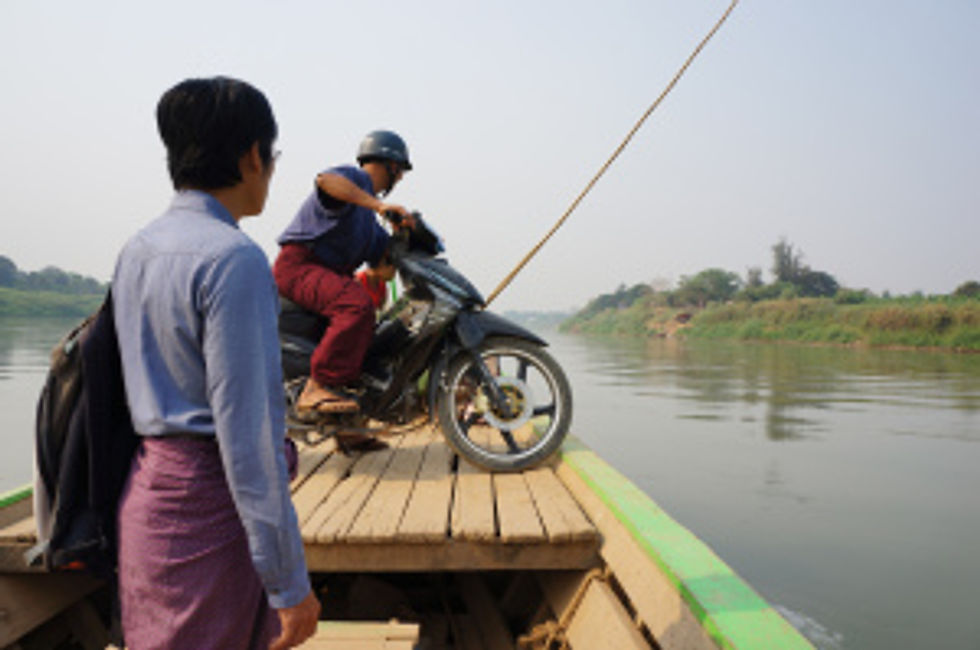
Below is a picture of the ferry we took to cross the Myingtge to Innwa. (Note, both men are in skirts called longyi. That’s the national dress.)
Many a would-be king would murder his uncle or brother and then establish a new city up or down river. And as with Johnny-come-latelys everywhere, most of them built monument to bolster their egos.
In Mingun upstream of Mandalay, Bodawpaya, the 4th son of the Konbaung founder, began building what was to be the largest pagoda in Myanmar. However, because soothsayers predicted that the dynasty would end upon completion of construction, the building was abandoned.
Here’s a picture of the enormous mass of bricks, just 20% of the actual planned pagoda.
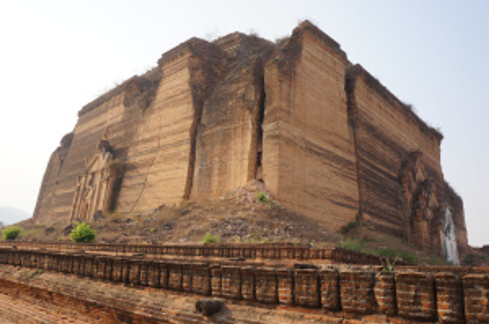
Apparently, one earns a lot of spiritual merit building pagodas. I guess someone who’s gotten to be top dog by killing his relatives needs the merit. But one can’t eat bricks. Bricks don’t teach children. They don’t cure the sick.
This particular incomplete monument to ego really underlined how meaningless our human ideas of success are.
In any case the Konbaung did not last. Bodawpaya’s son lost Tennaserim to the British in 1824. By the time the capital was moved to Mandalay, on another part of the Ayeryawaddy in 1857, Lower Burma including Yangon had been annexed. In 1885, the British marched into Mandalay, the last king Thibaw was sent away to exile in India and the whole of Myanmar became a British colony.
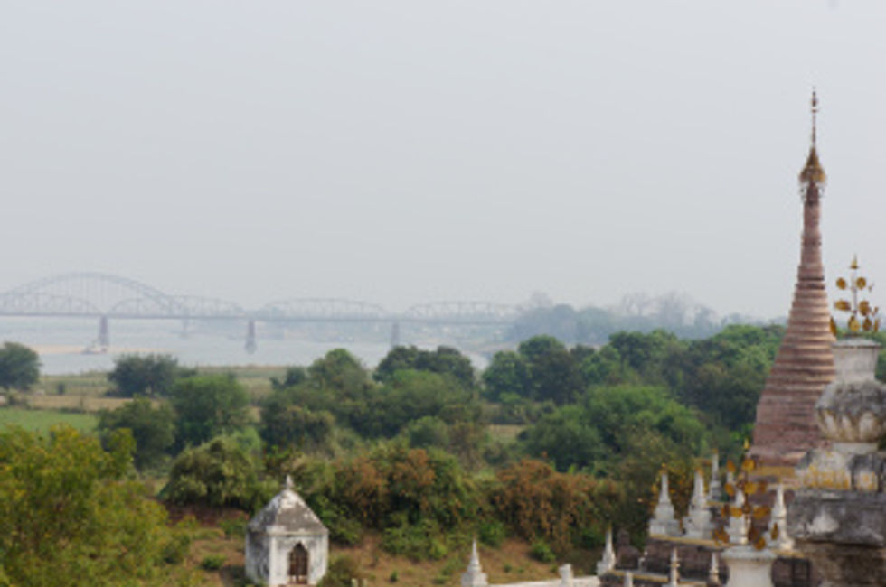
The British finally left in 1948. What remains is the bridge they built across the Ayeryawaddy in 1937.
What remains in the end after the centuries of kings, the years of colonization, the further years of solitude is the river and its sunsets and sunrises. And even that too will pass.


Comments